Laugarfell Hot Springs Winter Hike
This is a very beautiful and unique hike, offering an amazing experience to explore a narrow valley that was once carved out by raging rivers of Vatnajökull glacier. There are three beautiful waterfalls along the way leading up to Laugarfell hot springs at the end of the trek.
Trip Information:
- Distance: 12.9 km (8 mi) one way
- Elevation Change: 365 meters (1,200 ft)
- Estimated Duration: 2 Days
- Directions: From Egilsstadir to Mulavegur i Fljotsdal
- Alltrails Map: Laugarfell Hike
Important:
- Winter Route Information: If you’re planning to attempt this trek in Winter, you must have proper gear and experience navigating in winter terrain. You must also have some basic understanding of avalanche conditions. Based on my personal observation, there are few spots in the valley that are prone to an avalanche. Depending on snow forecast and direction of the wind, at certain areas inside the canyon, the wind-blown snow can form cornices that could create avalanche conditions. Please feel free to reach out should you need more information.
- Driving Directions and Trailhead: Based on Google Maps, the driving direction were a bit unclear. The end point on the road shows a Wilderness Center center, but in reality, it’s a private farmers house. The wilderness center is slightly East of the farm house. Please look at these coordinates: N64 57.874 W15 09.199 Please consider checking out their center, I’ve read online that it’s a very nice place, providing accommodation, dinning and entertainment. They can also take you up to Laugarfell Cabin (On Specialized Winter Vehicles) and you could stay there overnight and enjoy the hot springs (the tour might be pricey!) So check with them prior to your visit: Wilderness Center

Laugarfell Hiking Map


Trailhead Locations:
As we make our drive to the trailhead, we come to a full stop at a farm house parking lot, which kind of has its gates shut on the road preventing us from getting any closer to the trailhead, which seems to be running through a private property.
Serge is still thinking that this is a Wilderness Center. His original plan was to walk in and ask at the reception if we could leave our car here for a night. We saw a person outside working on the farm, so we kindly asked if it’s ok to leave the car here. The old fella didn’t really spoke any English, but he was very polite and kind to let us park there while we are doing our hike.


Trail Conditions:
We head out around noon as the clouds cleared up. It still rained a little from time to time in the afternoon. We have 8 miles ahead of us, and we do have thoughts that we might end up hiking into the night, which is fine because we have our headlamps.
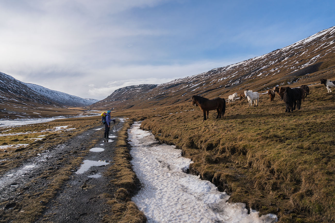
The trail was beautiful, gradually acceding through a narrow valley. Our expectations were that we would be walking in snowshoes and everything would be covered in snow. However, recent weather melted the snow and made trail conditions very saturated, with water levels running at 150-200%. At times it was difficult to navigate, potholing through snow, slipping on ice and having to cross stream after stream gave us a pretty slow pace. ]


Taking Unprecedented Detour
There were few large portions of the trail completely destroyed by a recent mudslide. By the look of things, it was massive! and the most terrifying fact is that it was very recent. Maybe day or two at most.
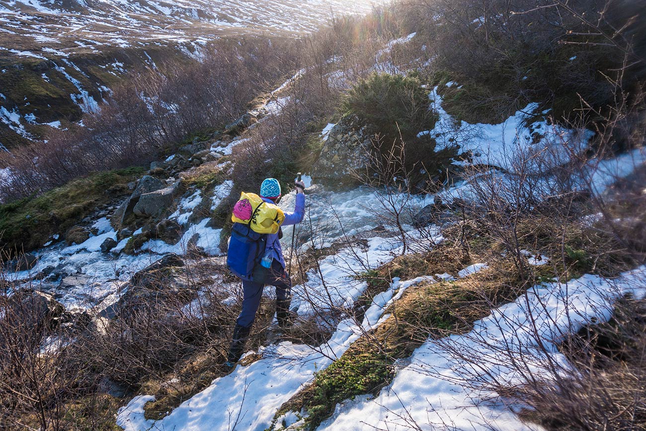
We come to a stream crossing where the ford is a bit stronger and deeper than previous ones. Neither Serge nor I want to walk through it and completely soak our feet. The best place to cross is by hopping through some rocks on the edge of a cliff, followed by a tall waterfall. No way in hell Serge is letting me cross there without being tied by a rope. Luckily Serge had a plan “B”.
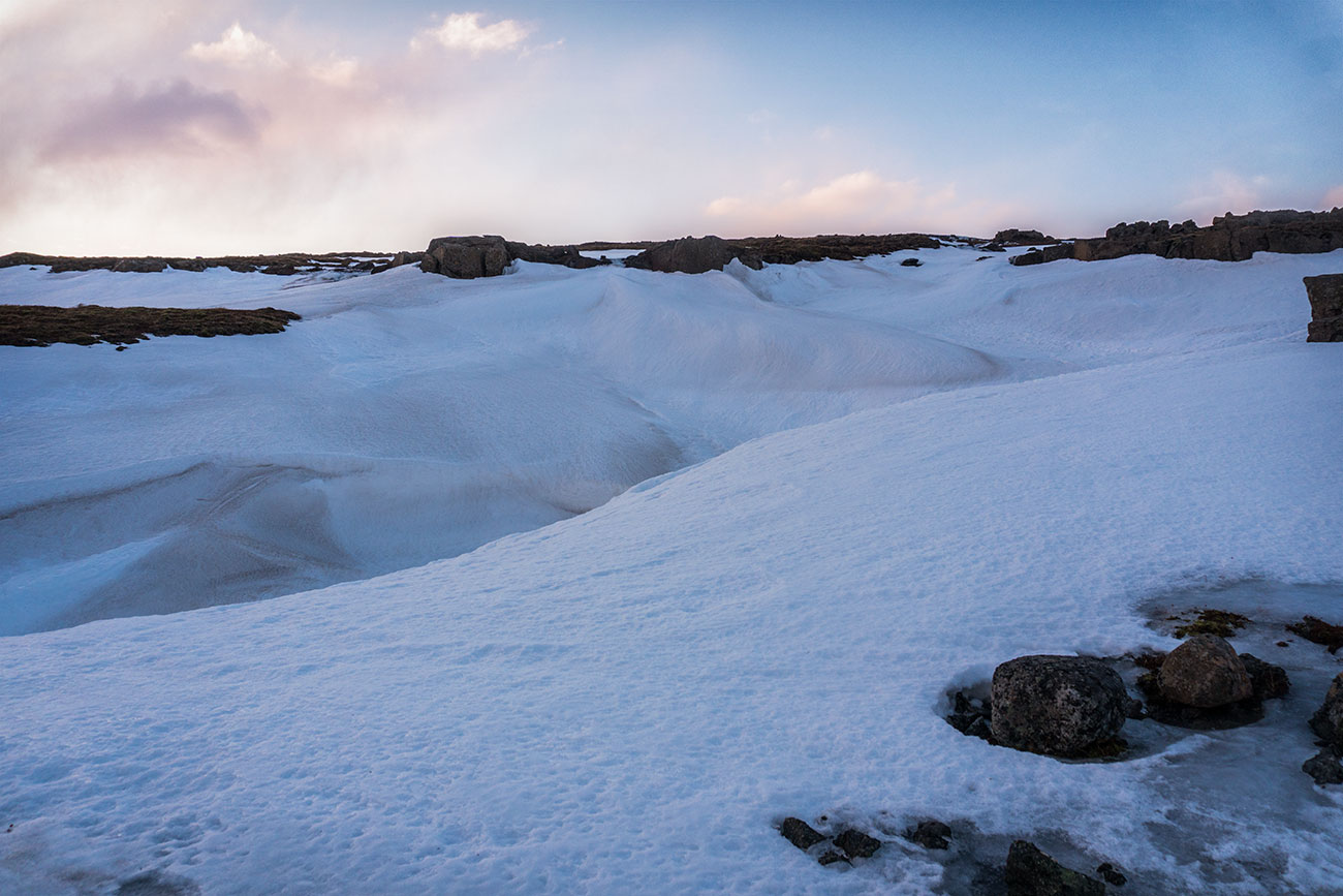


So we climb up a bit in hopes that there will be a better crossing somewhere uphill, before we know it, where there was just a small stream, it’s a river and a huge canyon between us and the other side. At this point we are not far from the top of the valley, where endless flatland’s wait for us. We decide to continue going up, still hoping to find a better crossing spot. At the top, it’s a stream land and everything is covered with a sheer layer of snow and melting ice, making it hard to tell which spots have rivers and which spots would be okay to walk on.
The sun is already setting, and we are about half way through, and we are way off trail. We have a GPS and know which way we need to keep moving. But crossing unfamiliar terrain is killing me, especially after we saw how our smaller stream turned into a deep canyon just before our eyes. I think I see Laugarfell in the far distance, but it is so so far away and I have fears of not knowing what’s between us. A deep canyon? A strong river that we aren’t able to cross? Or is there a river hiding somewhere underneath a sheer sheet of ice that we are walking on, and the thoughts of Randy Morgenson cross my mind. Serge did knew where the river approximately was and that we shouldn’t be walking on top of anything deep.

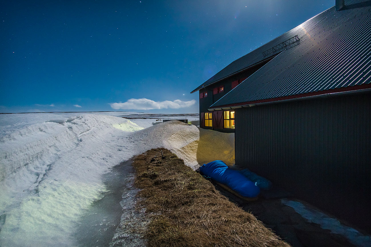
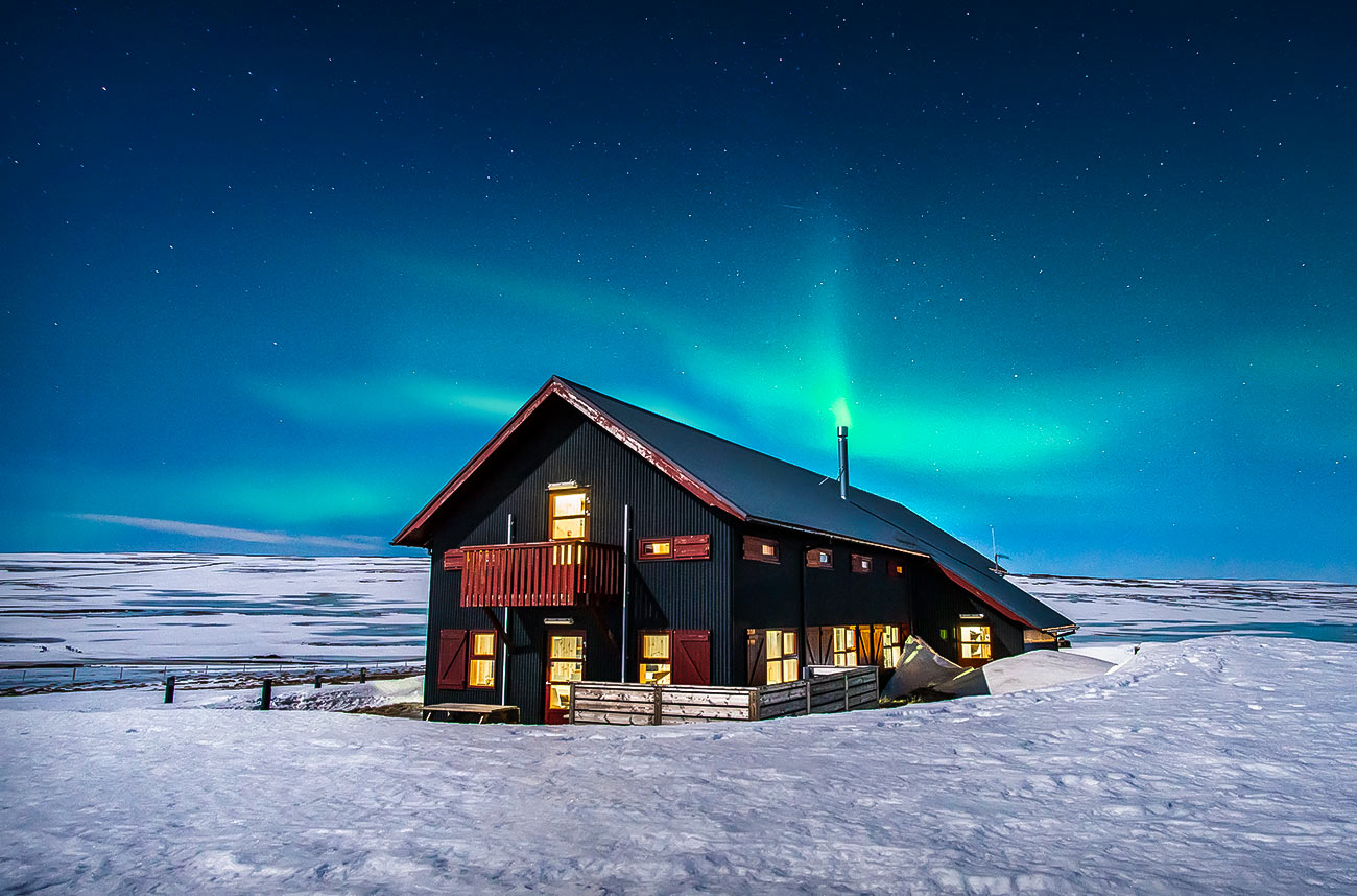
After several hours of walking on egg shells in the dark, we finally come to a paved road that leads to Laugarfell. We want to kiss it. The cabin is rarely used in winter and was completely locked, with a subtle light coming from the window that is powered by a generator. We set our sleeping bagspreparing to cowboy camp right next to the cabin at a spot that we felt like was most protected from the wind. We immediately jumped into hot springs, soaking our frozen limbs. The aurora greets us, making all of our worries go away.


We were very lucky to get a night of cowboy camping in Iceland in February with absolutely no wind, but it dip below -4 or -5C. The next morning, we traced our way back through the flatland’s, getting back to the trail and eventually to the little farm where our car was parked, just the way we came.
Doing some aftermath and assessing the unpleasant off trail night hiking situation, we knew that we would be safe, and this is why:
- We had enough food, water, and camping gear to make camp anywhere and spend the night, even if we didn’t make it to Laugarfell.
- Serge has diligently studied maps and terrain to know that not too far from us there was a paved road which leads to Laugarfell. If worst came to worst, we knew that we could always walk extra miles to the road.
- Serge had 2 different GPS trackers on his phone which always showed us the way we needed to go even when we were off trail.
- He also had extra phone battery to keep the GPS live when his phone started to die from cold temps.
- Lastly, Serge had a printed map and a compass if everything else failed.


