Overnight Hike to Bow Hut in Banff National Park

A short video showing my route from Calgary to Bow Hut by Serge Pikhotskiy on Vimeo

The bow hut hike is definitely one of those hikes where you can escape most of the crowds with the opportunity to stay at one of the Alberta’s Alpine Huts and enjoy the solitude of the Canadian Rockies.

Trip Information:


  • Distance16 km (10mi) roundtrip
  • Elevation Gain500 meters (1,640 ft)
  • Estimated Duration4 – 5Hrs one way
  • DirectionsFrom Banff
  • Alltrails MapBow Hut Hike
  • Additional Info: The Bow Hut typically needs to be reserved ahead of time. It will cost you on average 40$ per person. Follow this LINK to book your stay.


Serge is sitting on the deck and drinking hot tea at Bow Hut

I flew to Canadian Rockies early in October when most of the touristy crowds were gone. At higher elevations, several feet of fresh snow had already fallen. I encourage everyone to carry a bear spray and to never hike alone in Grizzly Territory or in Snowy Terrain. I also acknowledge that I don’t set a great example by hiking solo during this time of the year. Since I was traveling alone, it was my only option and the risk I was willing to take.

The trailhead to this hike is located at the Northern Edge of the Bow Lake, right by the Worlds Famous Num-Ti-Jah Lodge, which was often visited by one of my favorite writers, Dale Carnegie. For those who are not into backpacking or primitive accommodations of an alpine hut, I highly recommend staying at this place and make sure to book in advance as it gets super busy during high season.

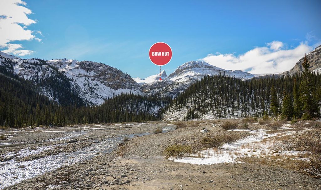
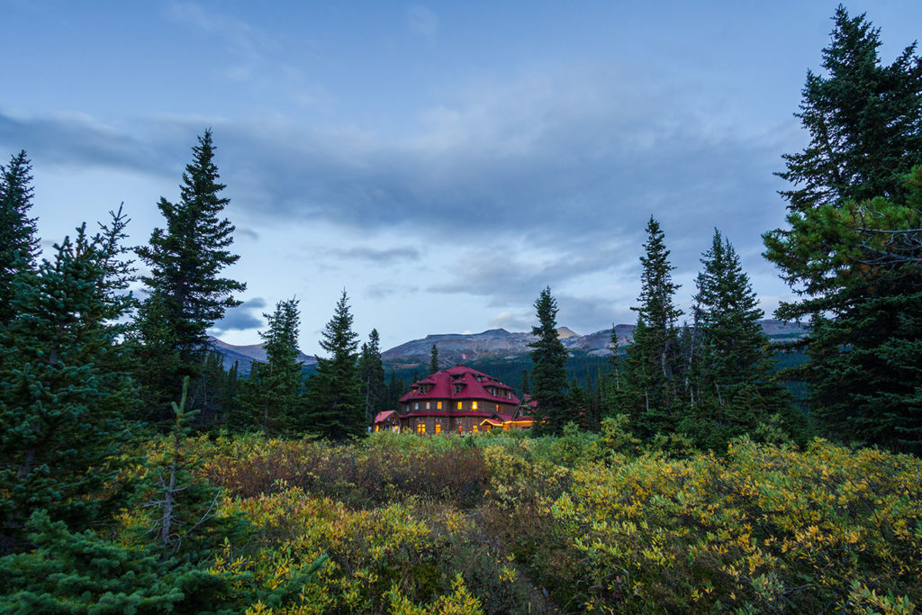
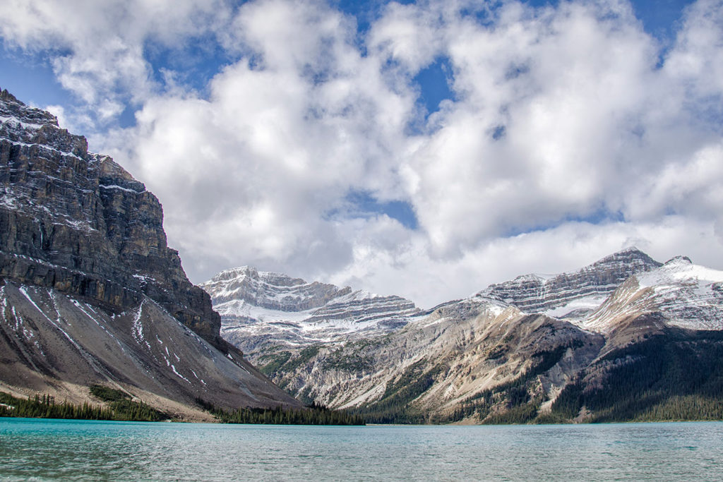
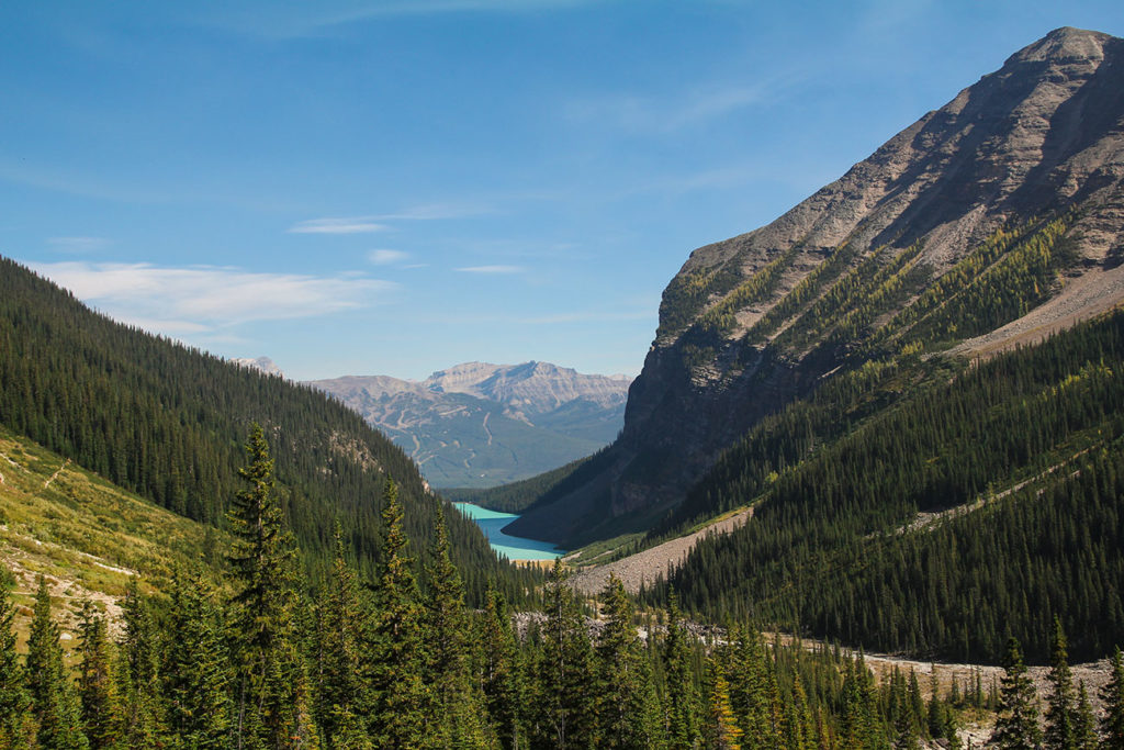
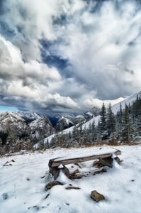
A view along the way. Bow Hut can be spotted far in the distance

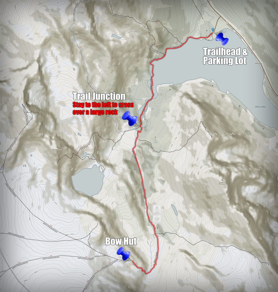
Once you depart the parking lot, the first half of the trail is pretty straight forward and you won’t experience much of any elevation gain. At one point, the trail will split up and you would have to stay to the left. Once you climb over the sketchy boulder over raging the creek (you can’t miss it) the trail will start gradually gaining elevation.

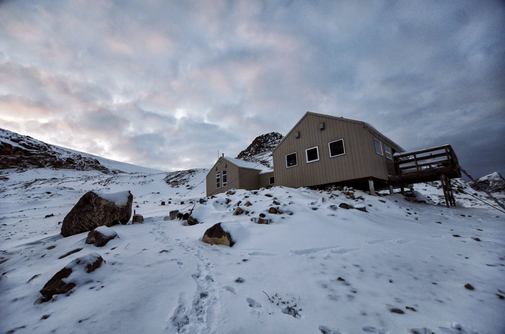
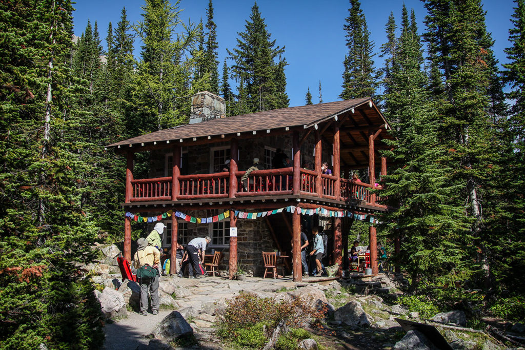
Another view from the Bow Hut

Once you get within one mile of the hut, that’s when you will have to do the hardest elevation gain. In my case, since I was there in early October, there was some snow accumulation which made it slightly slippery and difficult to get to the hut but not enough to warrant the need for additional winter gear (snowshoes/microspikes/crampons, etc). Plan appropriate gear depending on the time of the year when you’ll be making your ascend.

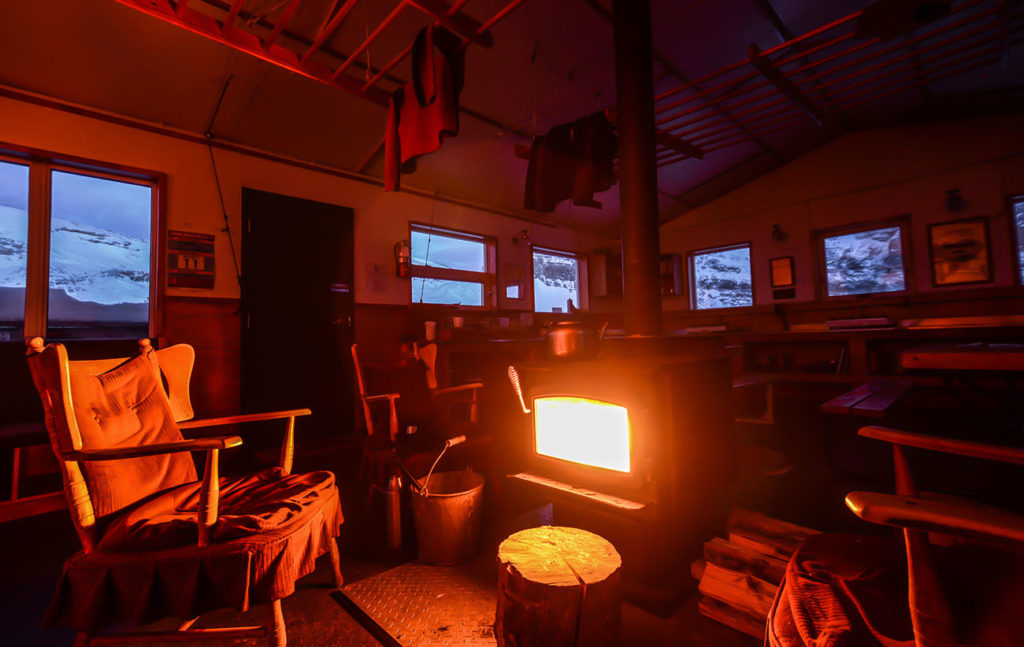
You will enter the hut using a lock code through a vestibule door. To the right, there will be a door leading to a common room/kitchen area and to the left there will be a door leading to bunk bed accommodation. There are also wooden logs outside that you can split and burn in the wooden stove if it gets too cold outside.

Since I was the only one staying at the hut, I decided not to use the bunk beds and chose to sleep on the floor next to the wood burning stove. It wasn’t a very hard decision to make since it got to -15C at night and I wanted to stay as close as possible to that warm & cozy stove.

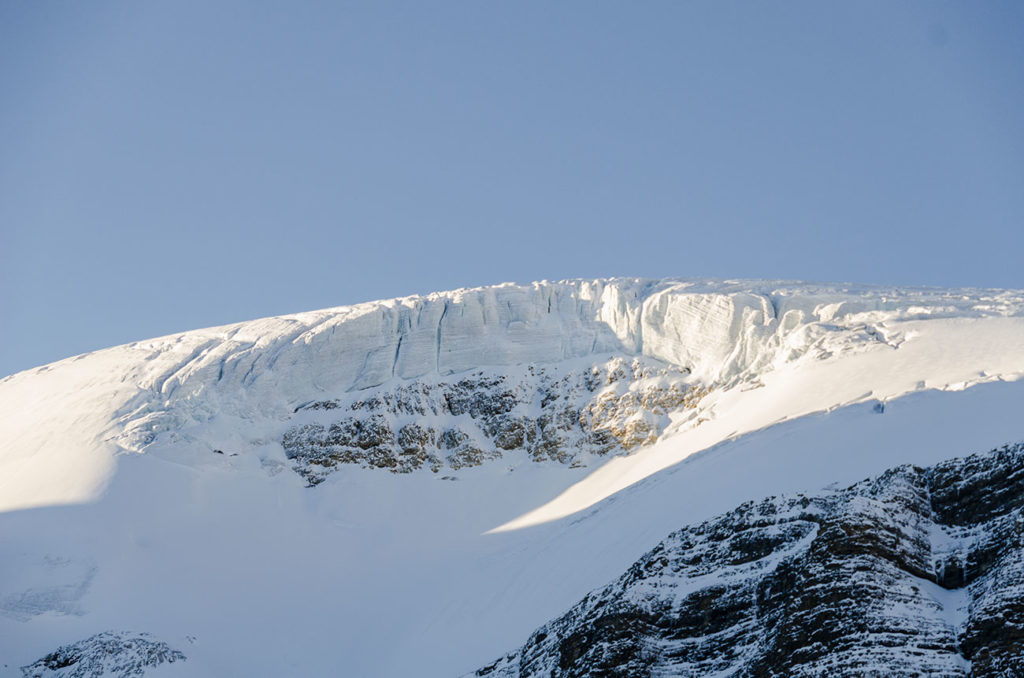
In the morning I woke up to a clear & beautiful skies. Some time was spent outside drinking hot tea and watching warm morning sun rays slowly wrap the the giant peaks.


Hiking The Narrows at Zion National Park

The Narrows

The Narrows canyon is a very unique and beautiful backpacking route that will take you through a stunning narrow corridor of giant rocky walls while walking on top of knee deep, crystal clear water of North Fork Virgin River. This trek is mostly done as a two-day backpacking trip, but can also be attempted as a long day hike.

Trip Information:


Important:


  • Flash Flood WarningThe stream can turn into deadly raging river in matter of minutes. Please make sure to check the weather forecast prior to your departure or stop by the visitors center to check for current conditions and advisories.
  • Permit RequirementsA wilderness permit is required for all “Top-Down” day hikes and overnight backpacking trips. In order to camp in the Narrows, you must book ahead and reserve a specific campsite months in advance (Only 12 sites available). If you’re planning to spend only few hours hiking in the narrows from south entrance near Temple of Sinawava, no permits are required. TIP: I highly suggest hiking for approximately two hours, in order to get to the narrowest part of canyon called the “Wall Street”
  • Shuttle Information: Departs at 6:15AM and 9:30AM and costs about $37.00/person. For groups of 8+ (10% discount is available) Additional information is available here
  • Canyon Shoes & Neoprene Socks: We’ve rented our Neoprene Socks and Canyon Shoes from Zion Adventures and Google Maps Address
  • Human Waste: If you need pee, it’s actually recommended to go and do it in a river. If you need to more then pee, make sure to pick up a “Restroom foil bag” when you get your permits from Visitors Office. Please respect the nature and pack it out!


The hike starts at the Narrows upper trailhead. In order to get there, you must book a shuttle or find someone who will take you up to Chamberlain’s Ranch, which is an 1hr 30min away from Parks South Entrance. We were lucky to meet a group who also were doing an overnight hike at narrows. So we agreed to drop off one of the cars at Canyon Junction Bridge and drove in the other up to Narrows Upper Trailhead. We had 5 people with 5 backpacks in a small compact car. Somehow we made it work!

For the first 3 miles, you will be walking on the dirt road fully exposed under the sun. Make sure to bring a hat or a sunscreen with you. Once the road ends, you will hike along the North Fork Virgin River until the trail disappear and it’s time to get your feet wet!


The next six miles in the upper section of the canyon are fairly exposed and somewhat wider with calmer water compared to lower section of narrows up ahead. As you hike further into the canyon, the walls start getting bigger and the canyon deeper and deeper.


North Fork Falls

Once you reach the North Fork Falls, you can easily bypass it through a little passage on the south side. Soon after, you’ll reach the river junction with Deep Creek and the water volume will increase as you enter a much more impressive section of the canyon.

Over the next few miles you will pass by few other confluences with Kolob Creek and Goose Creek along with few designated camping spots. As I recall, there are poles with luminescent numbers at each of the campsites that can be spotted at night with headlamps.


During next section you will encounter deeper parts of the river. Depending on water level, you might have to walk through waist or chest deep water. Make sure to empty your pockets and put electronics into ziploc or dry bags. You might also have to scramble over few large boulders along the way.


When you reach Big Springs, right after campsite #12, there will be a beautiful spring surrounded by lush green vegetation. This is a very beautiful section as you can see from the photos below. At this point, you will most likely start bumping into some of the day hikers as you will be approaching the end of your route.


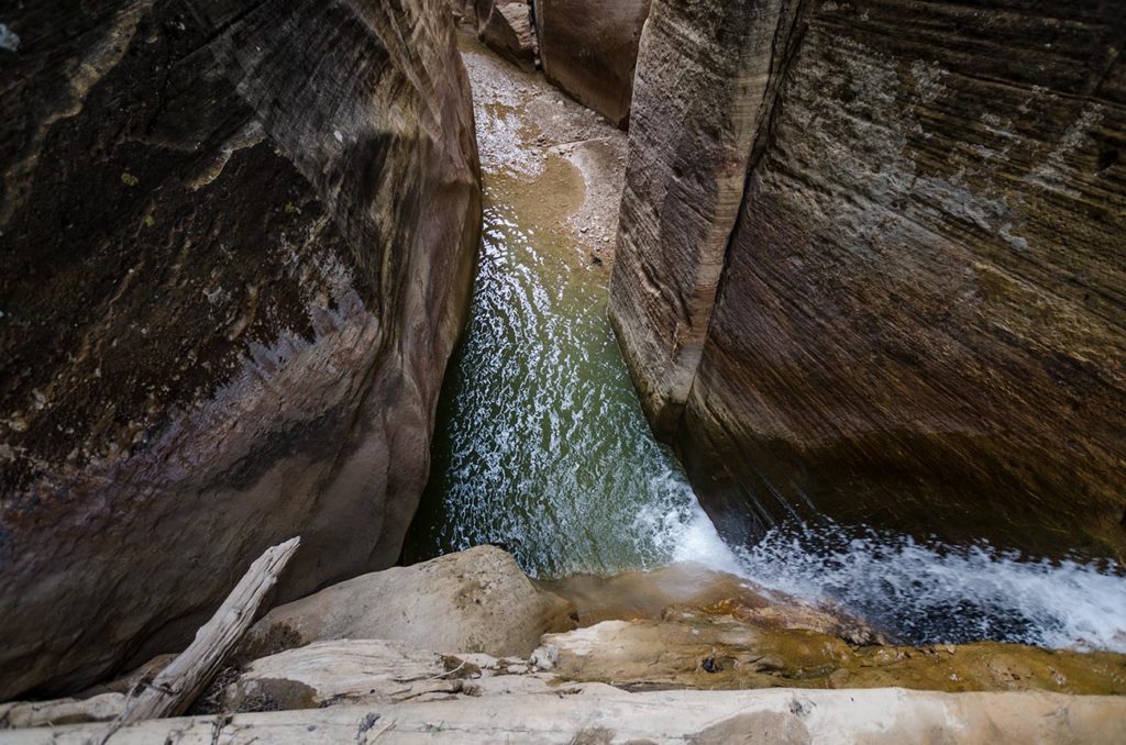
Magic colors of the canyon

When you reach Orderville Canyon, the area will slightly open up and you’ll have approximately another mile until you reach shorelines where crowds of tourists will be asking you about your adventure.


Observation Point Day Hike

The view from the observation point

If you’re visiting Zion in the hurry or just looking for another challenging hike. This is a must do trek for anyone who wants to experience the best views of the entire Zion Canyon.

Trip Information:


The Observation Point is a strenuous hike, with over 2,000 feet of vertical elevation gains that takes you up to the highest point of 6,500 feet above the sea level and has absolutely stunning views throughout the entire trail.

The trail starts at the Weeping Rock bus stop and shares a common trailhead with Hidden Canyon and a Weeping Rock Trails.


Looking at the Weeping Rock Bus Stop and Angel’s Landing in the background

You will cross a small bridge and will immediately start gaining elevation through a series of switchbacks. I recommend starting early in the morning or later in the afternoon, as you may be quite exposed to the sun during the ascend.


When you reach the junction with hidden canyon, you’ll see a steep trail going up through a series of switchbacks to a hidden canyon (I haven’t had a chance to hike this trail, but additional information can be found here. If you really like to get a taste of what this trail looks like, check out this video made by Kolby)


Once passed Hidden Canyon, the trail will continue to gradually climb until you reach the Echo Canyon. Suddenly, you will become surrounded by giant canyon walls that would block off the sun and experience cooler temperatures. After about a mile into the canyon, you will reach the junction with East Rim Trail.


Stay to the left of the junction and you will begin your final ascend through a serious of switchbacks. When the trail finally levels out, you will be hiking your final mile on the rim over sandy upper plateau.


When you get to East Mesa Trail Junction (a less a popular trail that can be accessed from East Boundary of the park), make a sharp left and hike for 0.4 miles until you reach the Observation Point. The views at the top are simply stunning! You will see the famous Angel’s Landing and the virgin river right below!


Serge and Dasha at the top of Observation Point


Stargazing at Cherry Springs State Park

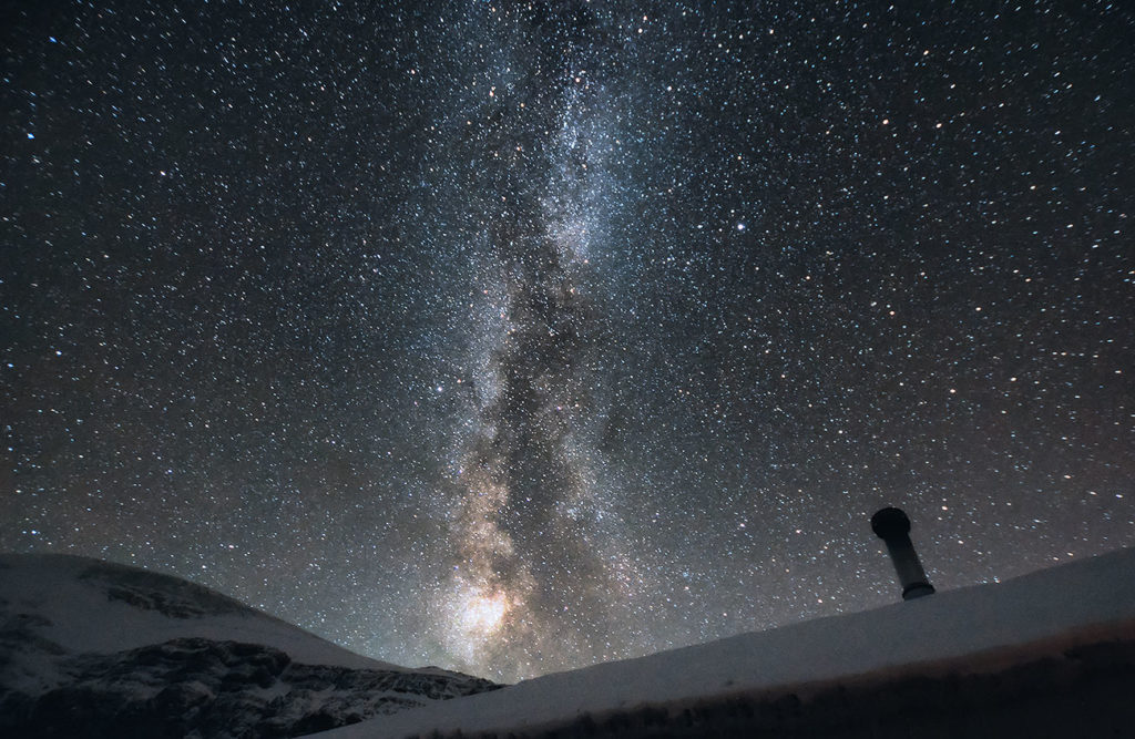
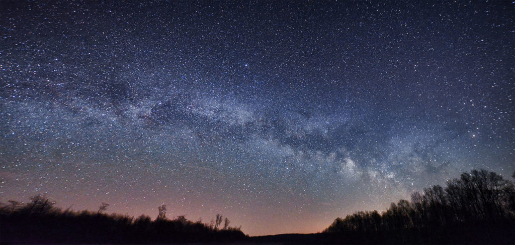
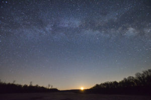
Milky Way at Cherry Springs State Park

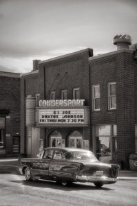
Believe it or not, but only 10 percent of Americans have seen a true dark sky. It’s somewhat unfortunate, but most of us live in or around large cities and it’s almost impossible to see any glimpse of stars in the night sky. The city lights and the pollution have taken over the views of stars in the night sky. But not in Cherry Springs State Park! Because of it’s isolated location in the mountains, Coudersport, PA still stands as one of few last strongholds on the East of United States.

When to Visit


  • Fall & Winterare the best times to visit. It may be chillier then, but the lessened humidity and extended night-time hours create excellent stargazing opportunities. The stargazing field at Cherry Springs is open year-round (as their “Astro Cabins” which have their own private stargazing fields, if you can book one).
  • Clear Sky ChartCheck out the Cherry Springs Clear Sky Chart for up-to-date look at how the skies are shaping up for your visit. Look for dark blue squares in the row marked “Cloud Cover” — dark blue means clear skies for optimal viewing conditions.
  • What to BringWarm Clothing with different layers, chair or a blanket, flashlight with red filter and binoculars.

Important Information:


We left Philadelphia right after work around 6-6:30PM and drove NW for about 4 1/2hrs. By the time we arrived it was already near midnight. Because everyone were watching or shooting the night time photography, we didn’t want to spoil the experience and look for our campsite with our bright headlights. We left the car at the main parking lot, took out our sleeping bags and cowboy camped in the middle of the Night Sky Public Viewing Area. We didn’t stay out for to long as we were tired from a long work week.


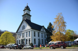
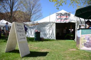
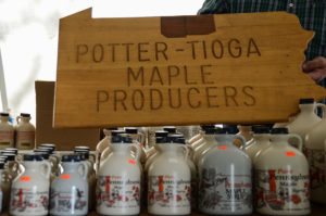
The next morning we drove to a small town of Coudersport, located only 20 minutes NW from the park. Lucky for us, they were hosting their annual Potter/Tioga Maple Festival. For a lot of locals it’s a great opportunity to showcase their products or just hang out with an old friends. You can sample and buy locally made maple sweets and treats ranging from maple mustards, salad dressings, sundaes, maple candy and even maple cotton candy. Sugar shacking demonstrations, the Maple Festival parade and the crowning of the Maple Sweethearts will highlight your weekend. If you’re looking for more things to do around town, check out this web page.


After spending couple hours in town, we drove around the park and visited some of the local scenic spots. We did some hiking around Lyman Run State Park and then returned back to our campsite to enjoy our fire and get ready for another night of dark sky viewing. There is quite a lot of hiking opportunity in the area ranging from 1-2 hours to 2 full hiking trips. All of the information can be found here: LINK


Lake Louise Plain of Six Glaciers Day Hike in Banff National Park

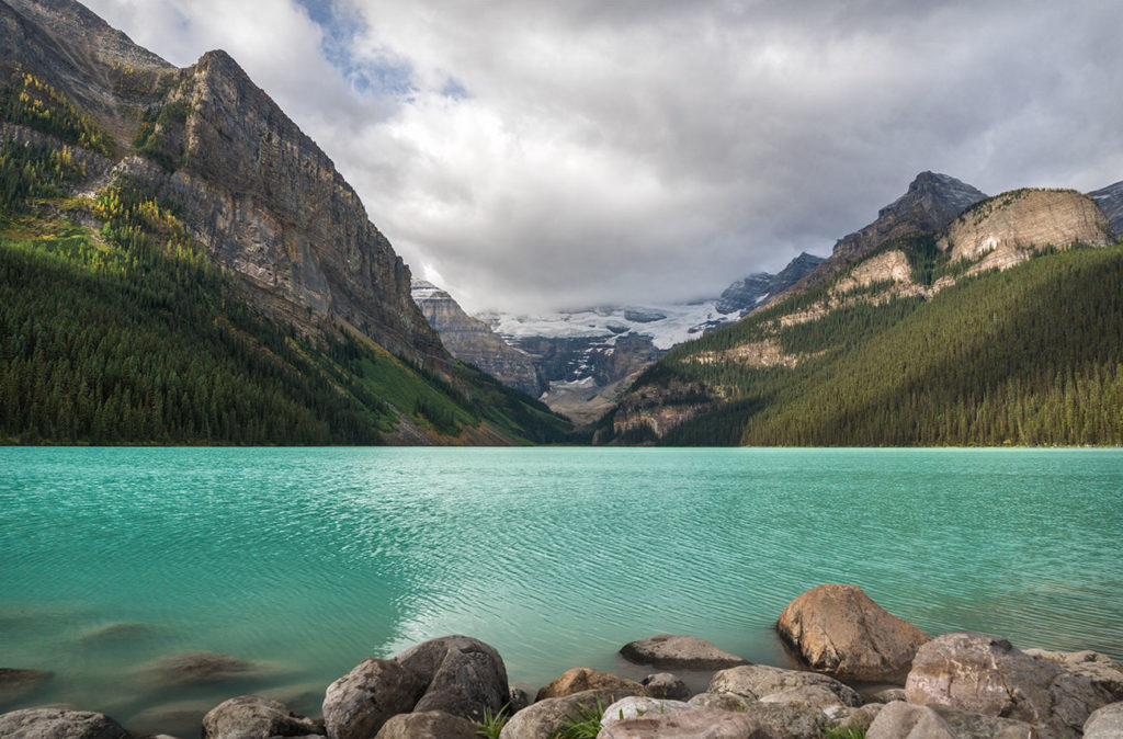
Lake Louise

A must do hike for anyone trying to explore beautiful landscapes around Lake Louise. This hike will take you through colorful shores of Lake Louise and up to a Tea House, where you can enjoy a nice variety of teas, in-house baked bread, chocolate cake and some lemonade. At the end, you will be rewarded with magnificent views of Lefroy Glacier.

Trip Information:


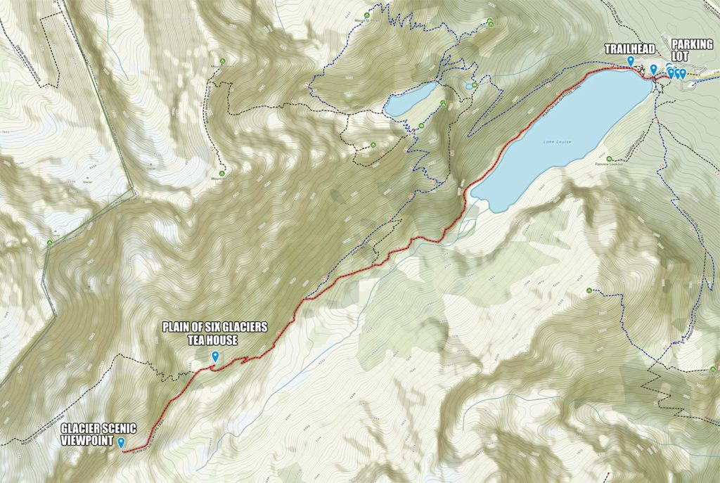
  • Distance13.6 km (8.5 mi) round-trip
  • Elevation Gain450 meters (1,500 ft)
  • Estimated Duration6 – 8Hrs roundtrip
  • DirectionsFrom Banff
  • Alltrails MapPlain of Six Glaciers

I would recommend starting as early as possible in order to beat the crowds and enjoy the solitude of beautiful sunrise over the valley. Please note, the parking lot behind the lake gets filled really quick and you would have to park at the alternative lot and possibly may need to take a shuttle to the lake from there.

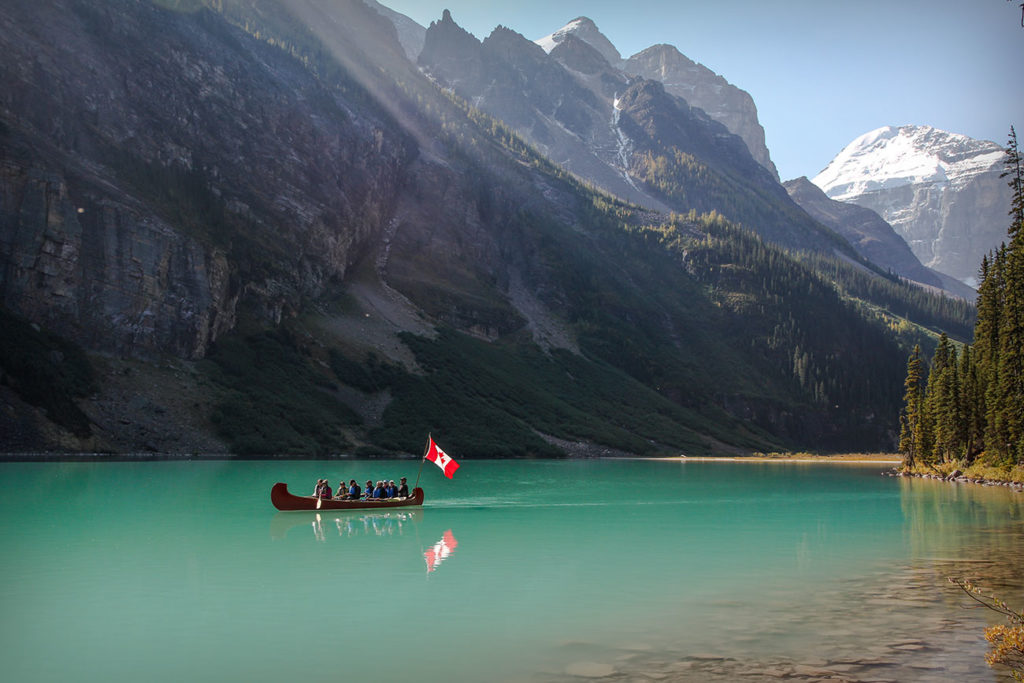
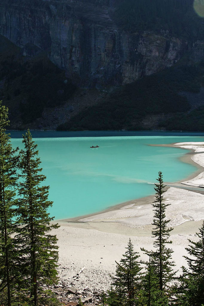
Historic Kayaking Tour

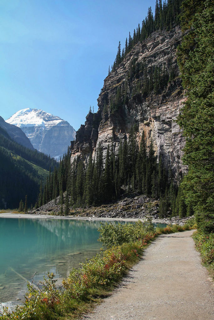
You will begin your trek along the shores of Lake Louise near Chateau. Make sure to ignore the Lake Agnes Trail on your right and continue along the lake shore to stay on Plain of Six Glaciers Trail. If you’re only looking to do a short hike along the lake, this could be a good turning around point as there is no trail that actually circles the lake. As you continue your hike, you will be rewarded with views of Chateau and less crowded atmosphere.

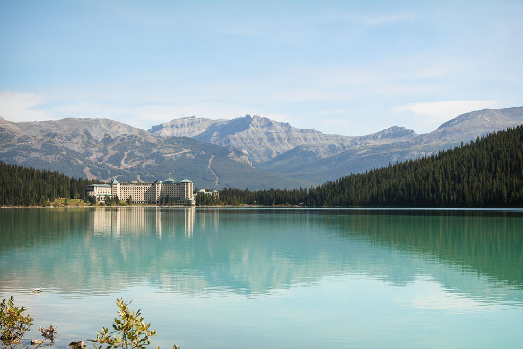
Looking back at World Famous Chateau

When you have passed the lake, the trail will slowly start gaining elevation. Once you’re above the treeline, you will start seeing some of the best spectacular scenery the Rockies has to offer. ]

At around 3.8 miles, you will reach the Tea House turnoff. I recommend visiting it prior to reaching the endpoint, because it will get a little crowded later in the morning and afternoon. We ordered hot soup, tea and freshly baked bread. You can also get lemonade, chocolate cake, chips, salsa and many other items from their menu. Groceries are delivered here by horse, so it definitely felt like a special treat!

Plain of Six Glaciers Tea House

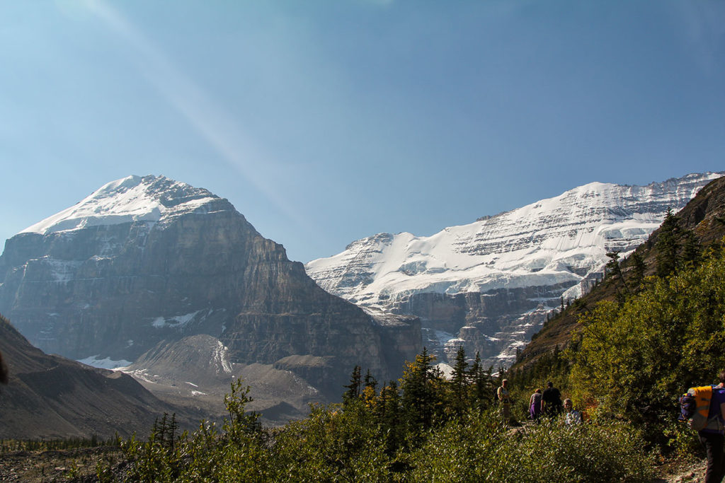
After taking some rest and crunching the hunger, we left the Tea House and continued on. The trail becomes slightly unmaintained, but no where near technical. You’re pretty much hiking on large ridge stairs on the north edge of Victoria Glacier until you reach the end wall of the valley. We ended up scrambling around trying to find a nice place to relax and inhale the view before turning around and going back to the parking lot.

Panoramic view from the top with tiny Lake Louise on the left and Victoria Glacier on the right.

Sulfur Skyline Trail Day Hike and Miette Hot Springs Near Jasper

The Sulphur Skyline hiking trail offers some of the most breathtaking panoramic views that Jasper has to offer. It’s a steep climb, bring lots of water, snacks and take some brakes along the way.

Trip Information:


  • Distance8 km (5 mi) round-trip
  • Elevation Gain700 meters (2,300 ft)
  • Estimated Duration4 – 6hrs round-trip
  • Driving DirectionsFrom Jasper
  • Alltrails Map Sulphur Skyline Trail


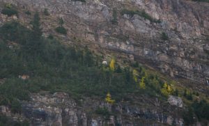
Find a snowman on this photo

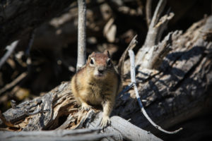
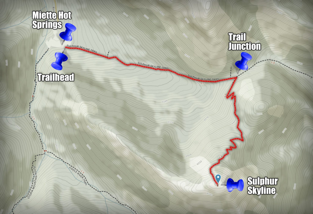
When you arrive at the parking lot, the Sulphur Skyline trailhead will be located on the right side behind the Miette Hot Springs building. Keep an eye out for mountain goats by the picnic area. They live and graze in the open areas around the Sulphur Creek.

Cascading Hills

First half of the trail is a gradual elevation gain through a dense forest with the occasional views of Sulphur Skyline and the valley behind. There is a very strong and distinct smell of pine trees and needles that will fill your lungs with freshness.

After hiking for about an hour, the trail will slightly turn to the right and get steeper. You will notice quite a few switchbacks that will continue until you get above the treeline.  Depending on the season, the trail gets pretty slippery. Make sure that your shoes have decent traction to stay firm on your feet along with proper gear (gaiters for fall & spring and snow shoes/crampons/microspikes for winter).

Can you tell this was our fist outdoor adventure ever!? Check out Serge rocking those dress shoes and jeans. Best lessons are learned from our mistakes.

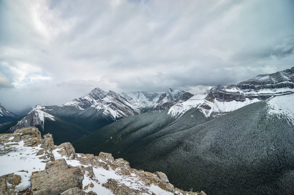
Once on top, you will be rewarded with beautiful 360 views of surrounding valley and mountains. There are plenty of nice spots to take rest, have lunch and inhale the view. Keep an eye for changing weather. Afternoon thunderstorm are very common.

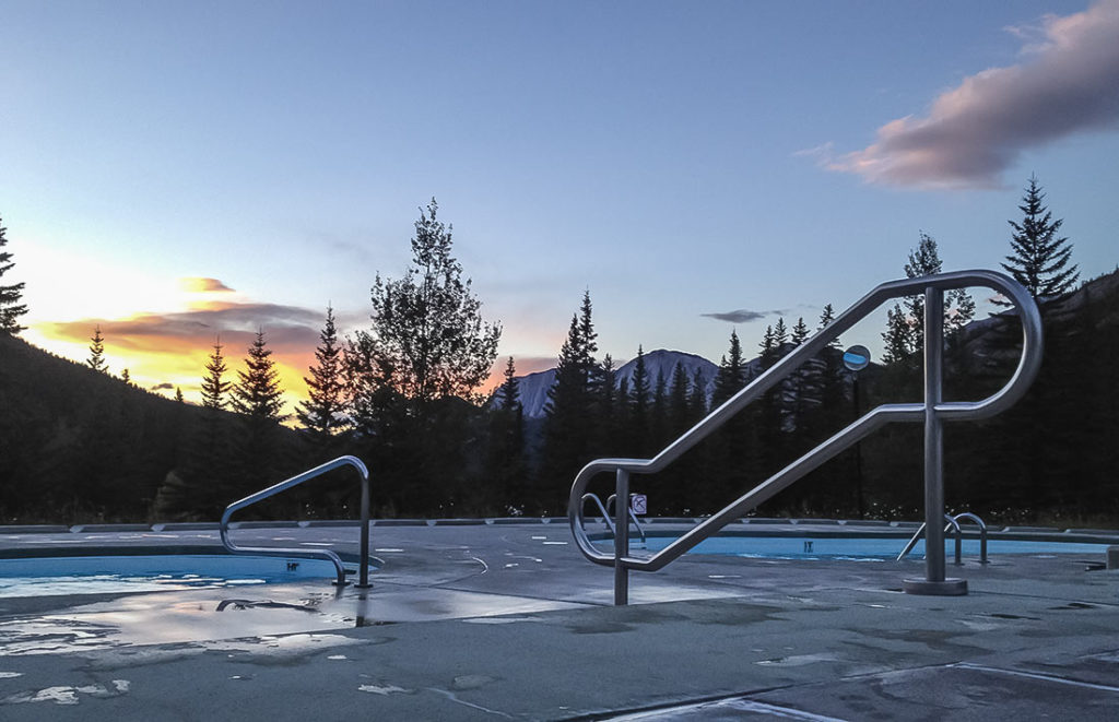
Sunset over Miette Hot Springs

Once you’re back at the parking lot. Leave your day pack in the car, grab some flip-flops, a towel and soak up in steaming pools of Miette Hot Springs. These hot springs are hands down much better and less crowded than Banff Upper Hot Springs. You get gorgeous scenery of the surrounding mountains and if you’re lucky, you may even catch a sunset. Best times to visit is in the morning and evening a few hours before close. There are several pools with different temperatures ranging from cold-warm-hot. Although chlorine is used in these pools, we felt like these were the best ones in the area. Additional information can be found at Miette Hot Springs homepage here: Link


Life in Liberia

Liberian Flag (on the left) – resembles American flag with only one star signifying the freedom the ex-slaves were given by The United States. Liberian Coat of Arms (on the right) – depicts the first ship that settlers traveled on to arrive in Liberia.


I knew very little about Africa, Liberia and non-profit work before signing up for this assignment. I felt like it is important to know a few significant events in history of Liberia to better understand the foundation that makes up this nation.

About Liberia*


1820 – 1847:

  • First settlers, freed slaves from US, arrive to Liberia.
  • Upon embarkment, 1/3 of emigrants die from tropical diseases.
  • The ones who survive and build the immunity struggle with harsh climate of wet downpours of the rainy season and scorching heat of the dry season.
  • Coastline is too rocky to cultivate for farming, while inland is so overgrown by jungle that when attempts are made during the dry season, the next rainy season washes away all the efforts.
  • People of the Republic of Liberia are declared to be the free slaves from America.
  • Natives, who outnumbered the settlers by 25-50 to 1, were strangers in their own land, subject to Liberian law but excluded from citizenship.

1870:

  • Liberia borrows $0.5 mil debt form London bankers in hopes to reinvest this capital into country’s economy.
  • The deal ended up being so poor, where Liberia paid more than $650,000 for a payment of less than $250,000. A financial hole out of which their government would not dig itself until early 20th
  • Such poor deals were often due to lack of financial acumen by Liberian representatives and opportunism and racism on the part of creditors.

1909

  • Investigation by US commissioners revealed that the treasury has been empty.
  • The role of treasury secretary usually went to a political insider with little experience in budgeting or even bookkeeping.
  • The corruption of the coast and the extortion of the hinterland radiated from Monrovia. The government payroll was bloated.

1924 – Firestone Deal

  • Yet again, Liberia seeks to find a creditor who would land $5 million.
  • Firestone steps up to the plate, but in exhange secures his rubber plantation deal – a 99 year lease for a million acres of land for 6 cents an acre per year.
  • As part of the deal, Firestone would pay no taxes, other than 1% levy on exports, which wouldn’t start for another 6 years.

1927

  • According to the Guinness Book of World Records, the most fraudulent election in history was at the 1927 presidential contest in Liberia. Presidential contest was won with roughly 235,000 votes when there were only 15,000 eligible votes in the whole republic at the time.
  • A big scandal uncovered that Liberian natives were leased out by private settler labor contractors (aka settlers were practicing slavery on natives).

1980

  • Natives and settlers shared a territory that on maps read” Republic of Liberia” but little else.
  • Constitution’s opening line read as “We the people of the republic of Liberia were originally inhabitants of the US”.
  • 133- year rule of Americo-Liberian elite was ended when a young sergeant, Samuel Doe – a tribesman native, has organized an operation to assassinate current president.
  • Unfortunately, when Doe took over presidency, his policies favored his own native tribe, while Liberia consisted of 16 ethnic groups.

1989 – 2003

  • A civil war breaks out with death toll estimates with no less than 100,000 out of a population of 2.5 million.
  • However corrupt, unjust, incompetent and occasionally brutal the Americo-Liberian regime of settlers had been, its crimes paled in comparison with the dictatorships, invasions, assassinations and unspeakable horror that followed during the war.
  • The electric grid and running water were so severally damaged, leaving the nation with little to no access to water or electricity.

2014 – 2016

  • Nation started to slowly build up after events of the civil war when largest Ebola outbreak fell on Liberia.

*Reference: James Ciment: Another America The Story of Liberia and the Former Slaves Who Ruled It

My Liberia:


One of the things that struck me was how similar is the economical state of affairs in the country today with its past history. It almost seemed like not much has changed. High corruption, drastic contrast between rich and poor, inflated salaries of government officials where some make up to $20,000 per month when an average Liberian lives on a few dollars per day. Country’s plentiful natural resources are given away to international investors who make poor deals with the government (just like Firestone and many others). Local cheap labor is exploited but most of the resources are not processed in the country which takes away potential for further economic development. A country where 60% of annual budget goes to pay government official’s salaries. A country where 95% of the budget goes to cover running costs, leaving only 5% for potential investment into economic development. A country where only 20% of population in the capital has electricity and running water.

Fourteen years of civil war followed by the biggest Ebola outbreak left a devastating impact on the mental well being of Liberian people.

Another important contributing factor is the educational gap that was created by the war (1989-2003). Today, Liberians in the age group of 30-40s should drive the economy. However, this age group has been affected by war when families fled Liberia to neighboring countries as refuges. Outside of trying to stay alive, continuous education was the least of their worries.

All of this became apparent within my first weeks of arrival in the country. One word – demoralizing. I knew my volunteering assignment had a narrow mission of its own, but I couldn’t help but think about the bigger picture, how my work fits into bettering this country and how far the light at the end of the tunnel is. Many international workers have this “fresh of the plane” syndrome – when they come, wanting to save the world and do not comprehend some of the deeper layers of issues that a nation is going through.

So now, I am in one of the poorest countries in the world, with a glim outlook into the near future. It took some time to get past those thoughts. I slowly started to carefully observe the day to day lives of Liberians and look at things not through the poverty lens of a Westerner, but rather understand how people live here. What I started to notice, were just ordinary lives. In the morning of a sunny day, I would see women hand washing their clothes (and boy do they know how to do their laundry and keep those whites white!). Little children bathing themselves in large basins, smiling at you and waving their hand to say hello. People gather around a water pump with empty canisters to fill up their household water for the day. Men hand washing their motorbikes and keke’s with soap in big puddles of rain water. In the evening, little charcoal stoves come out and women cook rice & soup in their big pots. Sunday is a big day – Church Day, and all the women wear their best vibrant outfits, traditional West African lapa dresses. I knew I had to continue looking for beauty in these smaller, less obvious things. One of the first things that made me start warming up to this country, was how kind and welcoming Liberian people were. With the recent scars from the war, they don’t often walk around the street smiling, but a friendly greeting will bring a huge smile to their face, and you will surely hear back an even friendlier “Hello”. That was really comforting.
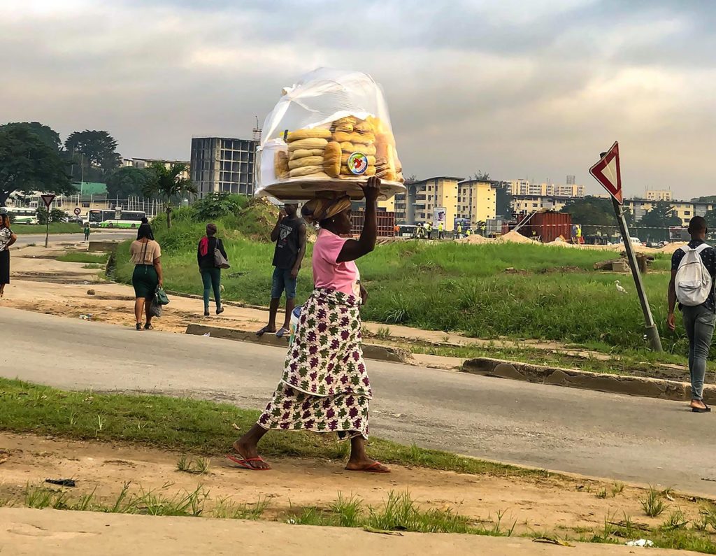
Woman carrying huge platter with stacks of freshly baked bread. The radiating heat from the bread makes the plastic coverage raise into a bubble filled with hot air.


When I first arrived in Monrovia, the air pollution from car & motorbike traffic (don’t know if they even have exhaust filters) was so bad that I’ve immediately developed a 2-day headache. Monrovia is located on the coastline. With time, I have learned to appreciate the ocean breeze more than ever. Especially in the early mornings, before rush-hour, the air is still clean, and breeze feels amazing during a morning run.
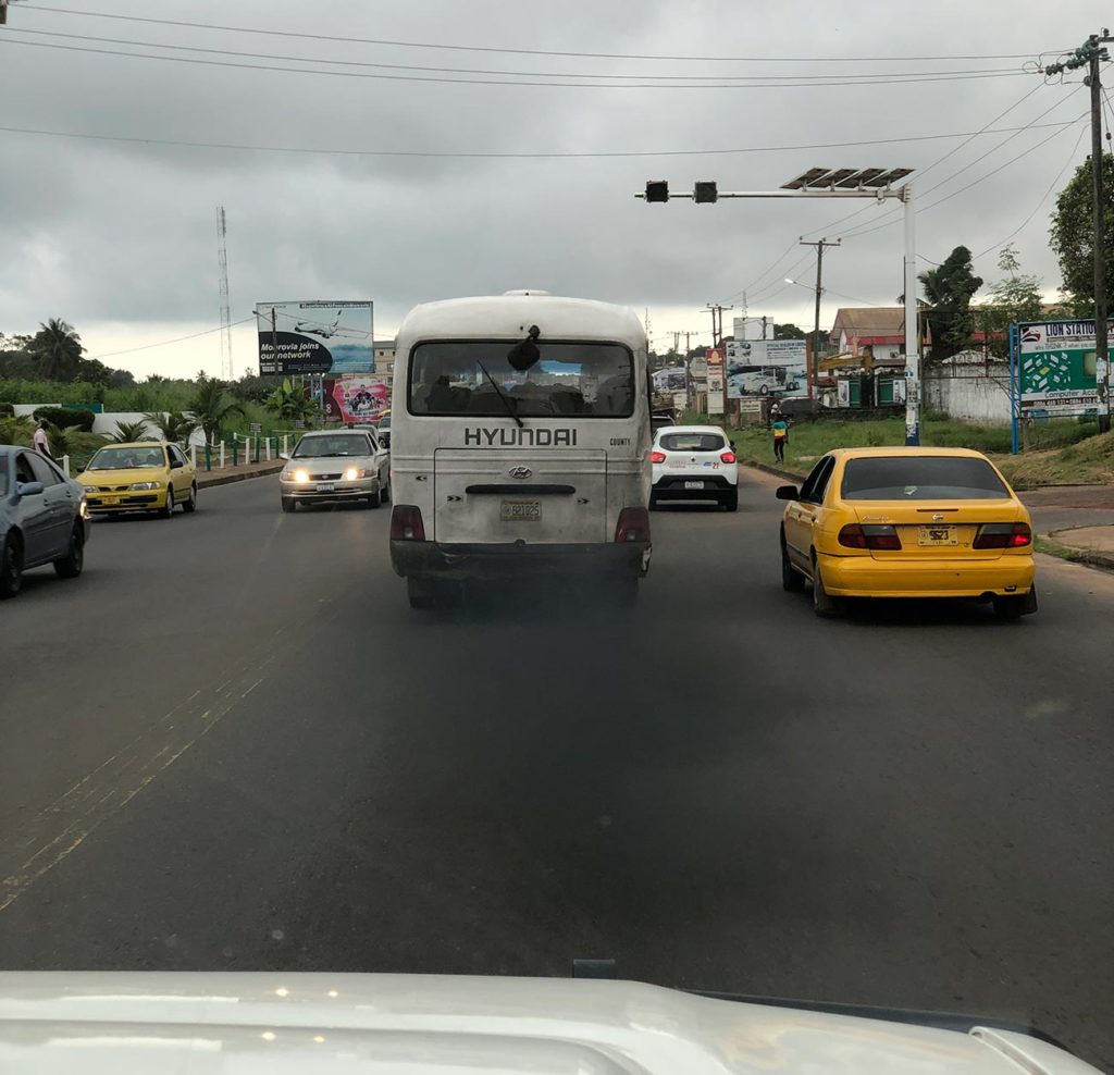
Typical air pollution from cars, trucks, busses, etc.


Liberian’s enjoy exercising and running. Football (aka soccer) is number one sport and is literally played in every neighborhood. On the weekends, you can see a lot of Liberians jogging, doing their stretches, and simply getting creative with their workouts with lack of fancy exercise equipment.

I also came to Liberia during the rainy season. Liberia is located on the 6th parallel away from the equator. This means that not only sun is hotter than ever but is also followed by constant 90% humidity and 6 months of the rainy season. Downpouring torrential rain. Boy did I enjoy the rain. Exercising in the rain, sleeping during the rain, even going to the beach in the rain was satisfying. But of course, a Liberian would not dare go out into the pouring rain unless absolutely necessary. Why? Because it takes forever for things to dry in combination with the humid climate. One of the things that struck me, was how Liberian women wash clothes and lay/hang them out to “dry” in non-stop rain. I was puzzled, slowly realizing that keeping things dry during the rainy season was almost impossible for the locals. As for the ocean – most Liberians do not enjoy the ocean, simply because many do not know how to swim and fear strong currents of the rough waters. I am using this example to show disparity of life for a privileged expat who has the comfort of their ventilated/air-conditioned apartment with awaiting hot shower and laundry versus a local who is living in a small home/shack with no electricity nor running water.
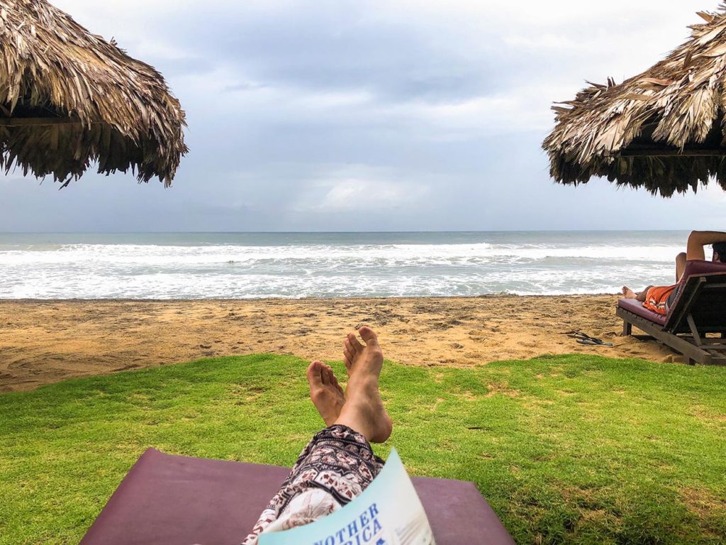
Rainy beach day.
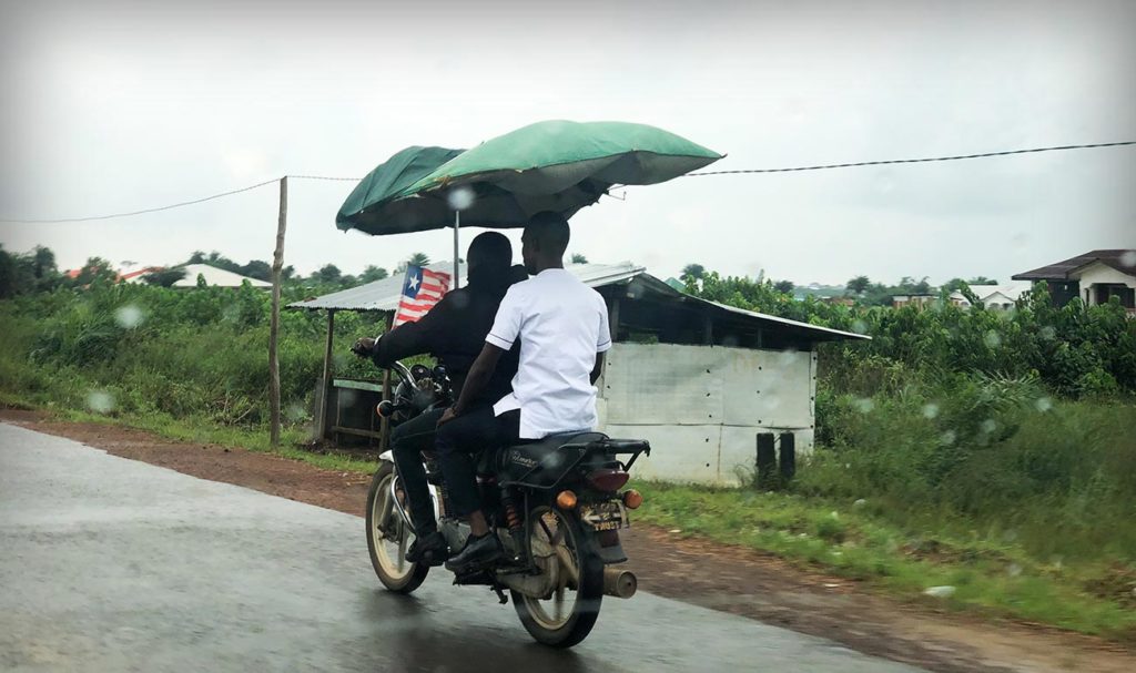
Motorbikes is a common way of transport. During the rainy season they attach a fixture containing of 2 umbrellas to allow passengers to stay semi-what dry.


Ok… back to the positive notes. Sometimes I am confused whether I should try to look for beauty in small things and enjoy life or suffer for the life that locals lead. It is a balance. And I believe that sympathizing with hardships of locals and trying to live my own best life here can be done at the same time.

I am embracing life here, integrating into the culture as much as I can, wearing traditional clothes, putting together my “African Music” playlist, reading books of Liberian authors, eating spicy palm oil stews prepared by Regina, our Liberian office cook who makes daily lunch meals of dried fish, fresh fish and poultry/beef over a plate of rice. Some of my international co-workers admire my ability to “live my best life” as they call it. But it is simply because I chose to look for beauty in everything. It is easy to carry the negative stigma about Africa. However, I believe that one can be in the most difficult circumstances, but they will always have the control over their response to those circumstances.


My favorite camera gear

Ultralight tripods

Emergency beacons

Useful phone apps

Ultralight backpacking

Partners in Health

Hello all…yes, it has taken me a whole month to collect my thoughts together to write the first blog. I have went through the stages of conditioning to my new life here. First, major culture shock, lots of downs and lots of whys. Then, I began meeting A LOT of people, locals and international workers who are involved in all different types of work raging from public to private sector (employees of numerous NGOs, CDC, Ministry of Health, embassies and journalists). Learning little by little about what this country is all about and what type of efforts are happening to make this ship stay afloat.

Day of departure from US. I seem to be overly excited for Liberia! Little did I know that I will never wear leggings or long sleeve again for the next 4.5months. Living on the 6th parallel away from equator is no joke!


My mind is filled with new information and my own observations that I am making here. I honestly did not know where to start when time came to share my experience. So I decided that I will write my blogs one at a time on different topics that I want to share with you guys. This first one will be about the work of my NGO.

What does my NGO do? In short, PIH helps deliver healthcare to communities in need. I am still learning about PIH, the actual work that they do and the impact. PIH responded to plea for help by Liberian Ministry of Health at the time of the biggest Ebola outbreak in 2014. One of PIH’s mottos “where we go, we stay”. Now that Ebola is under control, PIH is growing and focusing on other sectors such as HIV prevention, Tuberculosis, maternal health and mental health just to name a few. I personally love the last one because being treated for a disease such as TB or HIV is only part of the battle, the other is dealing with the negative stigma of having such illness and integration back to families and their communities.


You may wonder, what stigma is there around an illness like TB? It was quite eye opening to learn from my PIH colleagues. In some communities something like TB is not even recognized as a disease but is rather considered a spell or witchcraft for which the only treatment is prayer. Let that sink in. Secondly, treatment can take anywhere from 9-20 months. Imagine if you’re a sole provider for your family, it would be very unlikely that you would have the means to go to the only few clinics in the country that provide treatment which are probably hours away from your home. Many don’t go to see a doctor until it is too late, and one can only wonder how many others have now contracted this infectious airborne disease. To make matters even more complex, patient is admitted to an inpatient clinic during the first 4 months and then is released back home. However, they must return regularly to continue receiving their treatment for the following 5+ months. For some, travel between the clinic and home may be as long as 10 hours, if possible at all during rainy season. For those that do get persuaded to come in for treatment, PIH provides immense level of support besides medication such as transportation, meals for the patient and their families and any other necessities that may hinder patient from effective treatment. In addition, a PIH counselor works with each patient to help them integrate back into their communities.


The only TB clinic in Monrovia. It used to have 2 wards (male/female) for TB patients. Just several years ago, PIH refurbished 3rd ward for multidrug resistant TB patients. This is where patients spend their first months of their treatment until the disease becomes not active.


Monthly “Enabler Package” that is given to each TB patient: 25kg of rice, sardines, can of dry milk, bag of beans and bag of barley.


As part of my orientation, PIH took us to see TB patients in the clinic who are already in remission (not active disease state). We were given respirator masks to wear. I asked one of the nurses if that would be sufficient means of protection. To which she responded with a smile “Yes my dear, you had a meal today, and your body is strong to fight”. I had to let that sink in. One does not simply think that because we have access to food, at what immense advantage are our immune systems. A luxury that these TB patients don’t have.


With PIH medical colleagues who work with the TB programme.


Recently, PIH have introduced home visits. Where all employees are ought to go see a patient. Previously, it was only PIH medical staff who got to have patient interactions as part of providing medical care, but now the vision is for all staff even from supporting functions (HR, Finance, Grants and Procurement) to have an opportunity to meet our patients (PIH calls them our bosses) who are behind our day to day work.

Doing our first visit to the TB clinic, multidrug resistant ward. These patients do not have active TB anymore and are getting ready to be released back to their communities. Some don’t want to leave and ask to stay longer because quality of their lives is subpar to the care that they receive in the clinic.


Now, you may ask – Darya, but what is your role with PIH? It is known that NGOs operate on grants and donations. Some grants are received from private donors who are inspired by PIH’s mission and would like to support the good deed. Other grants are received from organizations and institutions who as part of their own vision are interested in supporting specific areas of improvement and thus provide funds to NGOs who drive such specific efforts of their interest. Such grants are considered “restricted” because NGO can only put that money towards a specific use or project. Most recently, such donors began implementing periodic audits, reviews and other reporting requirements to receive assurance around how their donated funds are being spent by NGOs. An unfavorable audit outcome can lead to reduced funding. With my background, I will be helping PIH strengthen their Grant Management processes and controls by identifying current gaps, implementing structured solutions and training employees to help instill a compliance & risk based mind set.

Apologies for insanely long blog. Next one may be just as long (because there is so much to share). In my next blog I will talk Liberia and what it is like to live here!


Meanwhile mosquitos here are viscous and are eating me alive. This happened within minutes without me even noticing! And it is impossible to catch them because they fly so fast ☹


MEET SERGE & DARYA

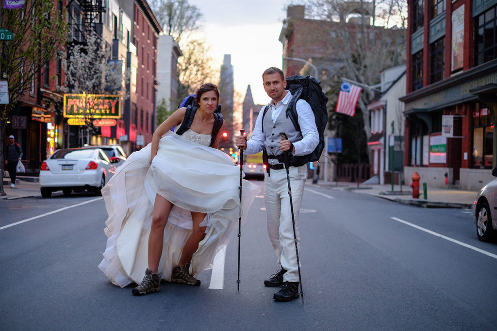
Yes, this is us! Posing in our full Hiking Outfit right after we got married. Better yet, we are getting ready to hike the Pacific Crest Trail for our Honeymoon!


Hey there…It’s us, Serge & Dasha! We love to travel and spend time outdoors. We are just an ordinary couple, who works 9-5 jobs and live in a concrete jungle, like most of us do. We try to make the most of our time and enjoy simple things that make us happy. We write to inspire our friends to take adventures and aid fellow travelers in having a better experience on their trips. We hope to motivate and challenge people to conquer their fears, get out from their comfort zones and experience the love and the beauty of our amazing planet. Drop us a few lines in the comments section or say “Hi” on the social media network!


Instagram | Facebook | YouTube | Twitter